
Search Spring Streets by Address
A Spring street directory works best as a sequence of checks, not as a household list. Normalize the number, direction, street type, and unit first. The physical parcel address can then lead to the Harris County Appraisal District, or HCAD, while the legal description can lead to the Harris County Clerk. A voter result and an old reverse directory are narrower clues. They may be absent, suppressed, stale, or outside the same county. For an address on the Montgomery side of the Spring mailing area, Harris systems are not the correct custodian.
- Use USPS address validation to standardize the number, directional prefix or suffix, street type, and unit. Keep the original wording from any old record alongside the normalized form.
- Search HCAD by street name and a narrow beginning and ending number range. Capture the account number, situs address, mailing address, and legal description for each likely parcel.
- Select the parcel in HCAD GIS, then click adjoining polygons. Treat each map click as a lead and confirm its account and legal description in the detail record.
- Use the legal description or the current grantee in the Clerk real-property index. Note the recording date, file number, instrument type, and parties before moving backward.
- For a current registration clue, use the Harris voter address search. For older household clues, consult a street guide or a reverse directory after checking that its geographic scope includes the Spring postal area.
Each step answers a different question. The appraisal account identifies a tax record, the deed names recorded parties, and a directory can preserve an older address association. None alone proves every person at an address.
Normalize a Spring Street Line
Postal formatting matters before a street search begins. USPS uses the delivery address and ZIP+4 to standardize a street line, but it does not provide a resident list. In Spring, a preferred postal city can span the Harris County CDP, nearby incorporated places, and parts of Montgomery County. Retain the number, direction, road type, and unit in both the source form and the USPS form. Older materials may also use a rural route, an acreage description, or a subdivision call instead of the modern number.
A ZIP is useful for narrowing a broad street result, but it is not a jurisdiction decision. The local record path changes when the parcel lies over the county line. A Spring-labeled address near Rayford or The Woodlands needs county verification before an HCAD or Harris Clerk search is treated as complete.
Use HCAD for Spring Street Ranges
HCAD's advanced real-property search is the principal Harris-side starting point for a street directory search. Its results are capped at 3,001 for an unconstrained search, so a street name should be paired with a beginning and ending street number whenever possible. A five-digit ZIP or school district can narrow a result further. HCAD accepts partial prefixes and case-insensitive text. The Similar Street Name control helps when a road-type or spelling variation is likely.
| HCAD field | Format or control | Street-search use |
|---|---|---|
| Tax Year | Optional dropdown | Sets the appraisal year. |
| Property Street Name | Optional text with Similar Street Name control | Finds the named road and likely variants. |
| Beginning and Ending Street Number | Optional number fields | Limits results to a block or small range. |
| ZIP | Optional five-digit field | Filters parcels, not people. |
| Owner Name | Optional text, last name then first initial or name | Checks a known appraisal owner. |
| Legal Description | Optional text | Connects a parcel to deeds and plats. |
| Key Map and Map Facet | Optional coded fields | Refines a mapped area. |
| School District, State Category, Building Style, Land Code | Optional selectors or fields | Adds property characteristics when needed. |
| Neighborhood Number, Total Value, Square Footage | Optional fields and range control | Further narrows a large parcel set. |
The HCAD search help illustrates the address and owner search route. Search and Reset are visible controls, and combinations are allowed. Avoid quotation marks and periods in the search text. A very broad street-only request can obscure the relevant parcels.
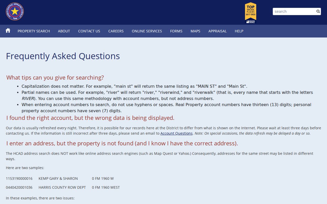
Once a parcel opens, preserve the actual field inventory: account number; owner name; property or situs address; owner and mailing address; legal description; subdivision or neighborhood; key map and map facet; land and improvement values; exemptions and jurisdictions; square footage; year, style, and land codes where populated; sketch or map; and ownership-history links. The map is approximate and HCAD is not a title opinion.
Read Spring Parcel Fields Carefully
HCAD labels the physical parcel location as the property or situs address. Its owner and mailing address is where notices go. Those fields can differ by city, ZIP, or state, and the mailing addressee may be a trust, entity, or representative. An owner name on the appraisal roll identifies the appraisal record. It does not establish every current occupant.
- Parcel
- A tract represented in the appraisal system by an account number and location details.
- Situs address
- The physical address of the parcel, distinct from the address used to receive notices.
- Plat
- A recorded subdivision map that can supply lot, block, road, and legal-description context.
- Criss-cross directory
- A reverse address directory that leads from an address to an alphabetical entry for a given year.
The Harris County Tax Office statement search can provide a statement, receipt, or account clue by account, name, or address. It is not the deed and does not replace the Clerk's ownership history. HCAD also says internet data normally refreshes nightly, so allow about three days before reporting a change.
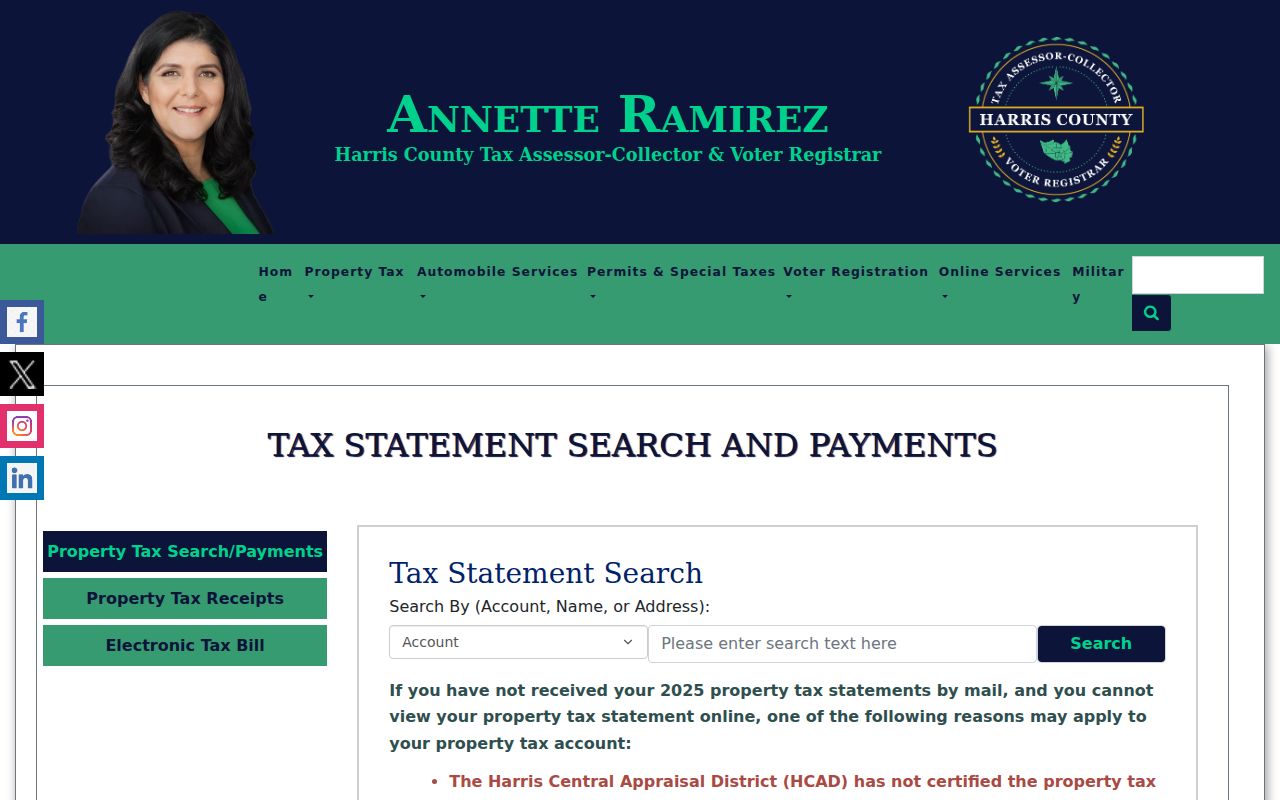
Use a tax-account result as a cross-check on the parcel account, then return to the recorded deed for a transfer history. A hidden account during certification, a change, or an opt-out is not proof that no parcel record exists.
Browse Spring Parcels in GIS
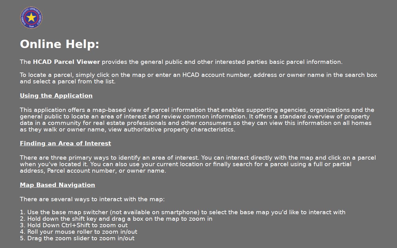
HCAD GIS makes the street-by-street part visual. Search a full or partial address, account, or owner, select the returned parcel, and use the popup for basic parcel information. Base maps can be switched, the view can be zoomed with the slider or shift-drag, and nearby polygons can be clicked in turn. Record a neighboring account, situs address, and legal description, then repeat the check in the HCAD detail record.
The HCAD GIS help page documents the parcel-selection and map-browse mechanics. Parcel boundaries are approximate and are not a survey. A neighboring polygon is a useful route to legal records, not an adjudication of where a boundary falls.
Values on Same Street and map browsing add context, but they should not turn a parcel inquiry into a claim about a household. A map account and a matching legal description form a better handoff to the recorded index.
Match Spring Addresses to Records
Several public layers use an address differently. HCAD provides the Harris-side appraisal account. GIS shows its mapped parcel and nearby polygons. The Clerk's real-property index records instruments and parties, while ePermits can date project and inspection activity. Voter records are registration tools with privacy limits. Historical directories and census sources can provide period-specific address clues. The table separates those purposes so a tax record is not mistaken for a residency finding.
| Address-keyed layer | Spring search method | Result and limit | Documented access |
|---|---|---|---|
| HCAD owner and situs | Street name, range, ZIP, account, owner, or legal description | Parcel owner or taxpayer and address fields, not all occupants | Free online, phone, or in person |
| HCAD GIS | Address, account, owner, or map click | Parcel geometry and adjacent-parcel leads | Online viewer |
| Clerk real property | Legal description, lot or block, party, file, film, or date | Recorded parties, instruments, and restrictions | Free index; paid images or copies; counter, mail, email, and fax routes |
| County ePermits | Property address, project, ESID, or permit number | Project and inspection timing, not proof of residence | Online, project login, county counter, or email |
| Harris voter lookup | Address search | Registration match subject to status and suppression | Online plus written or in-person request |
| Directories and census | Street guide, criss-cross, or address research | Older address association or household snapshot | Library shelves, interlibrary loan, staff research, federal archive, or library |
No public source is a complete who-lives-on-this-street dataset. Use the record named by the question: an appraisal record for a parcel, a deed for a recorded transfer, a permit for a project date, or a directory for an older address clue.
Follow Spring Deeds by Legal Description
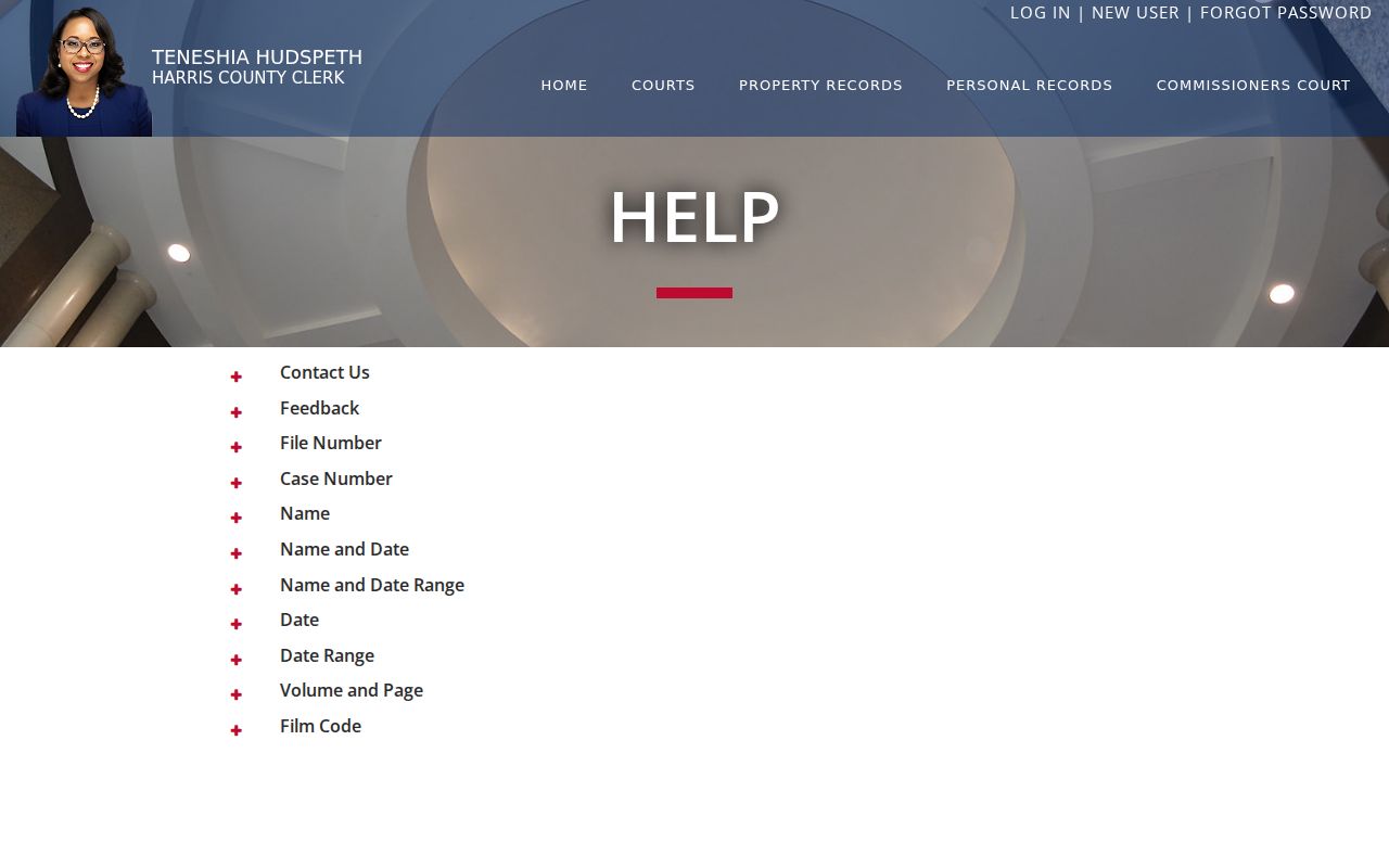
A modern street number may not appear in an older deed. Start with the HCAD legal description, then use the Harris County Clerk's Subdivision or Description, Lot, Block, Unit, Section, Abstract, Tract, or party fields. The Clerk also accepts file number, film code, date range, volume, and page. Names use last name first without punctuation, and a three-character partial name is accepted. A date-only query uses YYYYMMDD, with date ranges limited to one year.
The Harris County Clerk real-property search help describes its name, date, volume or page, and film-code modes. The free index has a reported one to two business-day recording-to-index delay. Online images begin November 1, 1960. Account images and watermark-free copies are paid, while a certified raised-seal copy follows the office or copy-order route.
Read the most recent deed and record the grantor, grantee, recording date, file number, instrument type, volume or page, and legal description. The former grantor becomes the next prior-grantee search. A deed of trust, release, assignment, or correction belongs in the timeline but is not automatically a transfer. For older images, use the Clerk counter, TSLAC reels, direct and reverse indexes, or archives material.
Date Spring Structures With Permits
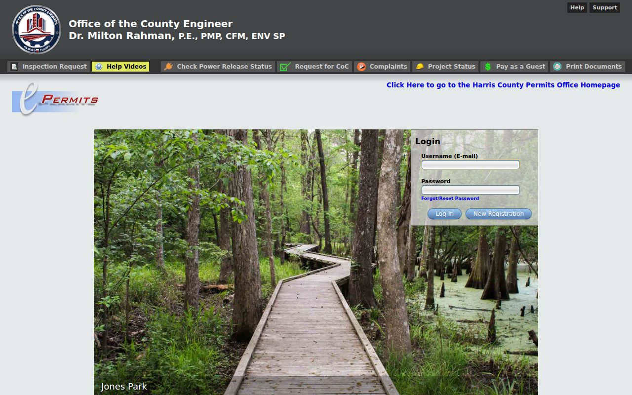
For an address in unincorporated Harris County, the county says development needs a permit. County permit guidance routes a search through the property address, project number, or ESID. The inspection-request screen also accepts a permit number in a format similar to 2201010001-ABC-001 and displays inspection details after its grid filter and search controls. These records can date construction, alterations, inspections, or a project. They do not establish who lived at the address.
The Harris County ePermits portal also presents project status, power-release status, certificate-of-compliance requests, complaints, guest payment, and document printing. When online material is limited, use the county permit counter or its documented email routes. The permit office lists 1111 Fannin Street, first-floor lobby, 713-274-3900, and weekday hours of 7:30 AM to 4:30 PM.
A Houston municipal route applies only after municipal jurisdiction is confirmed. A Spring mailing address by itself does not establish that Houston holds the relevant permit or court record.
Check Spring Voter Results Carefully
The Harris voter lookup has Current Registrations and Pending Registrations choices, plus Search by Name or Search by Address. An address query should use a direction without a period, such as S Sam Houston. A return is a registration result, not a guaranteed occupancy list. A person may use a mailing address, be in suspense, have a pending record, or register outside the apparent Spring ZIP.
Harris Elections also accepts written public-information requests and offers in-person inspection. Its request process asks for a description of the records, may estimate charges above $40, may require a deposit above $100, and says inspection is free. The state master-file route requires a notarized noncommercial-use affidavit and a $75 deposit, and is limited by Election Code rules. Do not treat a suppressed address or a blank result as proof that a person has no connection to a street.
Verify Spring Street Jurisdiction
Spring is an unincorporated Harris County CDP, not a single incorporated city government. The popular Spring region also reaches the Montgomery County line, The Woodlands, and the Rayford side. Postal ZIP areas, Census CDP lines, school districts, MUDs, ESDs, constable precincts, and municipal limits can all split differently. HCAD is a hard Harris County boundary, so it cannot settle a Montgomery-side parcel.
Use a USPS-normalized address, then confirm the parcel county before choosing the assessor, clerk, or permit office. A ZIP filter in HCAD returns parcels and tax accounts, not people. The same rule keeps a Spring street directory search grounded in the record keeper that has authority for the address.
Read Spring Streets in Older Directories
For a target year, look in a street-and-avenue guide or a reverse, often called criss-cross, directory. Find the address and then turn to the alphabetical entry. Capture the publisher, title, year, page, and abbreviations. HPL and the Houston History Research Center hold criss-cross directories from various publishers and titles from 1925 to the present, but no official source confirmed a continuous Spring-specific run.
Check a Houston or Greater Houston volume's geographic scope before using it for the Spring postal area. The historical volumes themselves belong on the Spring Directory Book; here they are a final address-based check. The latest full public census was the 1950 census when this research was assembled, and it offers a period household snapshot rather than a current result.
Request Missing Spring Street Records
When an online index does not expose the needed page, ask the custodian for an existing record, index page, file number, or date range. A Texas Public Information Act request should identify the office, describe the records narrowly, say whether inspection or copies are preferred, and provide a delivery method. The Attorney General says no reason is required. An office should produce records promptly or, if it cannot do so within 10 business days, communicate availability or explain the delay.
The PIA does not require a county office to create a new report, run a new analysis, or answer an open-ended question. Harris County Clerk routes include the central counter, annexes, mail, eCommerce, phone, fax, and email. County Archives holds permanent and historical records from more than 70 county offices and accepts appointments by email or phone. This fallback chain is especially useful when an older deed image, historical street reference, or file is not in the public interface.